Click On NY 30 on the Map Above
Looking South towards Blue Mountain
Hot Tips
Computer - Web: Leverage all the social media sites you can to support your main website. A Facebook business page is the most important, followed by Instagram then Twitter. Don't forget to make sure your Google and Yelp listing pages are okay. But keep the focus on your main site and don't get bogged down in endless social media chit chat, which might be fun but it doesn't generate good traffic after a while.Auto: Get Your Car's Heating System Checked Out for as well as all your lights. Modern car systems throw a "check engine" light if the engine's thermostat is stuck open or stuck closed. Mount good mud & snow tires and even put on chains for deep winter snow driving.Outdoors: Winter is here. Wear at least one wool layer and a shell parka if hiking above 3000', besides heavier layers of fleece & a good hat. Take basic emergency supplies, headlamps and snow shoes even for day hikes.
NY 30 Facts:
It starts in the Southern Tier, off of NY 17, the Southern Tier Expressway
The Adirondack Park parts are in Fulton, Hamilton and Franklin Counties.
NY 30's extension into Quebec, PQ 138, is over 865 miles long, goes thru Montreal & ends up near Labrador.
Just south of Tupper Lake, NY 30 crosses into the southeast corner of Saint Lawrence County for less than a mile.
Hamilton & Essex Counties are the only ones totally in the park, and Hamilton is the 3rd largest land wise with the smallest population in NY State.
The Adirondack Trail is NY 30A from Mayfield south to the Thruway I-90.
Summer's Right Around the Corner. We got a lot of rain so at least the foliage is growing in lush.
Services & Shopping
Inns, Resorts, Bed & Breakfasts Motels and Cabins
Dining
Campgrounds
General Stores
Gas Station/Convenience Stores
Real Estate, Vacation Rentals
Hardware & Building Supplies
Gifts, Furniture & Antiques
Groceries
Insurance And Financial
Culture & Entertainment
24 Hour Stores
Automotive
Free Want Ads
Topographic Maps
Northville, Great Sacandaga Lake Topographic Map
Hope, Great Sacandaga Lake Topographic Map
Wells Area Topographic Map
Indian Lake Topographic Map
Horseshoe Lake
Speculator Village Area
Long Lake
Big Tupper Ski Resort Topographic Map
Tupper Lake
Ampersand Mountain
Blue Mountain Lake
Robert Moses State Park and St Lawrence River Topo Map
Saranac Lake Village
Upper Saranac Lake Topo Map
Tupper & Saranac Lake 1985 USGS Quad
St. Lawrence County Road Map
Towns and Villages
Amsterdam-Mohawk Valley
Broadalbin
Mayfield
Fonda-Fultonville
Johnstown
Gloversville
Northville, Northampton & Benson
Hope & Wells
Speculator & Lake Pleasant
Indian Lake
Blue Mountain Lake
Long Lake
Tupper Lake
Tupper Lake Webcam
Big Tupper Ski Resort
Other Useful Links
About Route 30
Driving Rules and Tips
Responsible Drivers Information Guide
Winter Tips
Directions
Other Links of Interest
Saranac Lake Chain District, Lake Clear Junction
Paul Smiths, Saint Regis
Town and Village of Malone
Constable, Trout River - Canadian Frontier
Great Side Routes Saranac Lake Village, Ray Brook, St. Armands
NY 86 to Lake Placid on AdkI87.com
NY 37: Saint Regis, Akwesasne Mohawk Reservation, Westville, Fort Covington
Horseshoe Lake
NY 458 to St. Regis Falls
Why NY State Highway 30?
It's a great, long, fun road to drive.
There are plenty of interesting places and cool people to meet.
It goes through the less used, less expensive parts of the Adirondacks.
The wilderness areas are less crowded, unlike the High Peaks mob scene.
There are good properties for sale at reasonable prices in the Park.
It's extension into Quebec, Canada (PQ 138) goes directly into the City of Montreal.
Why Not?
A Guide to the all the natural wonders, towns and villages, shopping, services and outdoor fun along the main North-South blue route through the Adirondacks


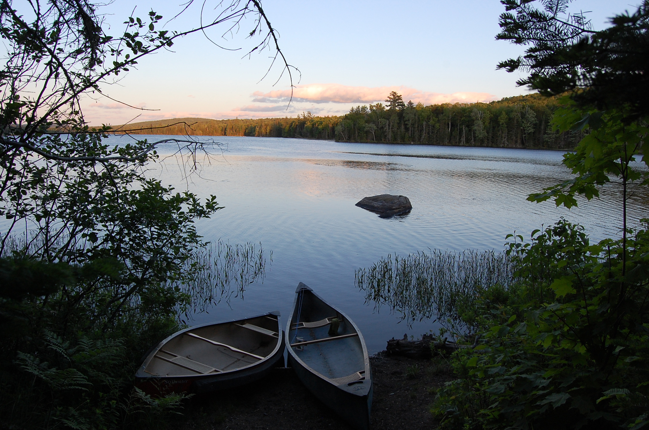 Canoes on Lake Durant, near Blue Mountain Lake.

