Main Street, US 11, NY 30 in Malone, from the Salmon River Falls Park
Malone used to be part of the Town of Chateaugay before it was formed in 1805. In the War of 1812, malone had the dubious honor of being sacked and burned by the British Army out of Canada. Today it is the largest village in and the county seat in Franklin County. The downtown area is full of old mill buildings.
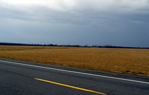
The Town of Malone boundary is the Adirondack Park boundary on NY 30; you'll go through a cut and over a rise in a farm field, where you can see a hundred miles north and west into Canada. Geographically, you have now left the Adirondacks and are now on the Northern or Laurentian Plateau of the St. Lawrence River Valley. Or in other words, you're out of the woods and on the plains. The plateau is very flat, just like our Northern Great Plains. The Village of Malone, the Franklin County seat, is just ahead. The road is fast and straight into the village, so play it safe and do the 30 mph speed limit.
From Lake Clear Junction, there is the abandoned northbound railroad spur line to Malone, which is now a major snowmobile trail. Since Malone is out of the park, there are a lot more snowmobile trails and the motels in the area cater to people sledding in that part. Using the RR trail, you can sled to Tupper or Saranac Lake on the Adirondack Railroad main line. There is also a good downhill ski area in the southern part of the town. There are a lot of rivers up here for fishing and good hunting amongst the old farms on the plains. There is also good golfing I am told.
East Salmon River Falls, Malone Village, off of US 11/NY 30


 East Salmon River Falls, Malone Village, off of US 11/NY 30
 Main Street, US 11, NY 30 in Malone, from the Salmon River Falls Park
 of the St. Lawrence River Valley. Or in other words, you're out of the woods and on the plains. The plateau is very flat, just like our Northern Great Plains. The Village of Malone, the Franklin County seat, is just ahead. The road is fast and straight into the village, so play it safe and do the 30 mph speed limit.